
Global Travel Information
Elbe River Length & Source: Key Geographic Facts
The Elbe River: Tracing the Journey from its Source to the Sea
One of Europe's great waterways, the Elbe River, carves a profound path through the heart of the continent. It is a river of history, a corridor for commerce, and a lifeline for ecosystems. For anyone curious about its fundamental geography, the questions are often direct: Where does this mighty river begin, and just how long is its journey? The answers unfold into a fascinating story of geology, history, and the enduring power of nature. This exploration will guide you from the river's humble origins in the rugged mountains of the Czech Republic to its dramatic meeting with the North Sea, providing a comprehensive understanding of the Elbe River's length, its source, and the incredible journey in between.
Our geographic quest begins at the source of the Elbe River. Nestled in the northwestern corner of the Czech Republic, in the region known as Czechia, lies the Krkonoše Mountains, also called the Giant Mountains. This rugged, picturesque range is home to the river's birthplace. More specifically, the Elbe River source location is identified as a small, spring-fed wetland on the slopes of a mountain called Violík, at an elevation of approximately 1,386 meters (4,547 feet) above sea level. It is a surprisingly tranquil and modest beginning for a river that will later become a broad, powerful force.

Visiting this spot today, you will find a symbolic stone enclosure marking the precise origin of the Elbe River in the Krkonoše Mountains. A nearby plaque, inscribed in both Czech and German, commemorates the site, which has been a point of pilgrimage for centuries. The water initially trickles out as a small stream, known locally as the Labe (the Czech name for the Elbe). This initial stream begins its descent, quickly gaining volume from other mountain springs and melting snow. The significance of this location cannot be overstated; the water that seeps from this alpine meadow embarks on a transformation, starting as a crystal-clear mountain brook before evolving into the central artery of Northern Germany. Understanding the Elbe headwaters in the Czech Giant Mountains is key to appreciating the river's entire character, as the energy and purity of its mountain beginning influence its flow for hundreds of kilometers.
")
From its source, the river's path dictates its ultimate Elbe River length. But how is this length actually measured? The total distance the Elbe River travels is generally accepted to be 1,094 kilometers, or about 680 miles. However, it is important to note that river lengths can vary slightly depending on the measurement techniques used—such as satellite imagery versus traditional cartography—and which specific channel is measured in the vast estuary near its end. Some sources may cite figures a few kilometers more or less, but 1,094 km is the most widely recognized and authoritative measurement.
This impressive distance makes the Elbe one of the major rivers in Central Europe. To put this total length of the Elbe River into perspective, its journey is longer than that of the Rhine from Lake Constance to its mouth, though the Rhine as a whole system is longer. The Elbe's course can be divided into three distinct sections: the Upper, Middle, and Lower Elbe, each with unique geographical and ecological traits. The Upper Elbe flows from the source through the Czech Republic, passing through cities like Hradec Králové and Pardubice, and famously carving a deep canyon through the Czech Highlands. At the German border, it begins its Middle Elbe section, flowing through the scenic Elbe Sandstone Mountains, a region of spectacular rock formations often called "Saxon Switzerland." Finally, from Magdeburg onward, it becomes the Lower Elbe, a lowland river that widens significantly as it approaches the sea. The Elbe's path through Central Europe is not a straight line; it curves and bends, first flowing south, then west, and finally north-west, draining a basin of over 145,000 square kilometers.
The river's journey from its source is one of constant change. After leaving the Krkonoše Mountains, it flows through the Czech interior, where it is dammed to create several reservoirs. It then pushes through a stunning natural gorge, the Porta Bohemica (Bohemian Gate), before crossing into Germany near the town of Schöna. This is where the river reveals one of its most breathtaking landscapes: the Elbe Sandstone Mountains. Here, the river has cut a dramatic valley through the sandstone, creating a paradise for rock climbers and hikers. The course of the Elbe River through Germany then takes it past the historic city of Dresden, often called "Florence on the Elbe," and onwards through the fertile plains that have sustained agriculture for millennia.
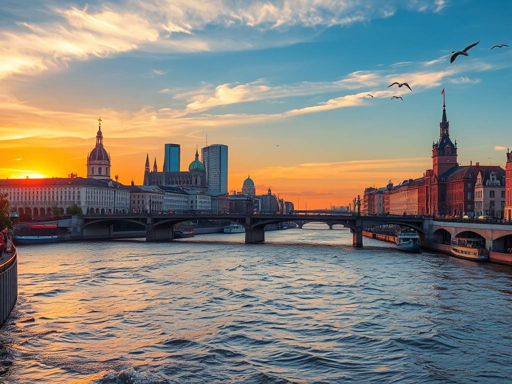
As the river continues north, it passes the cities of Wittenberg, Dessau, and Magdeburg. The landscape flattens, and the river slows and widens. The character of the Elbe changes dramatically in its lower section. It becomes a mature, lowland river, meandering through floodplains and marshes that are of immense ecological importance. The Elbe River Biosphere Reserve in this region is a UNESCO-recognized site, providing a sanctuary for countless species of birds, fish, and plants. This section of the river is also heavily engineered, with dikes and canals to control flooding and facilitate navigation. The final chapter of the river's journey is its transition into a tidal estuary. Around the port city of Hamburg, the freshwater of the Elbe begins to mix with the saltwater of the North Sea. The river widens into a vast channel, subject to the ebb and flow of the tides. This Elbe River estuary and its North Sea outlet is one of the most significant commercial zones in Europe, with the Port of Hamburg being a major hub for global shipping. The river officially empties into the North Sea at Cuxhaven, completing its 1,094-kilometer journey from a tranquil mountain spring.
The Elbe source to mouth overview reveals more than just geography; it tells a story of connection. For centuries, the river has been a vital navigation route on the Elbe, linking the landlocked Czech heartland with the global sea lanes of the North Sea. It has witnessed the rise and fall of empires, the flow of trade from the Orient to the West, and has inspired artists, composers, and writers. The geography of the Elbe River basin has directly shaped the history and economies of the regions it touches. Furthermore, the historical significance of the Elbe River's path was cemented in modern history when American and Soviet troops famously met at the river near Torgau in April 1945, a pivotal moment marking the end of World War II in Europe.
In conclusion, the story of the Elbe River is a captivating geographic tale. Its journey begins at a specific, marked spring in the Czech Krkonoše Mountains at 1,386 meters altitude and ends 1,094 kilometers away where its waters merge with the North Sea. This Elbe River key geographic facts profile highlights a dynamic watercourse that is at once a natural wonder, an economic engine, and a historical landmark. From its origin of the Elbe River in the Krkonoše Mountains to its final broad estuary, every kilometer of its length tells a part of the story of Central Europe itself, a continuous flow of water, life, and history.
相关文章
- Elbe River Cruise Routes: From Hamburg to Dresden
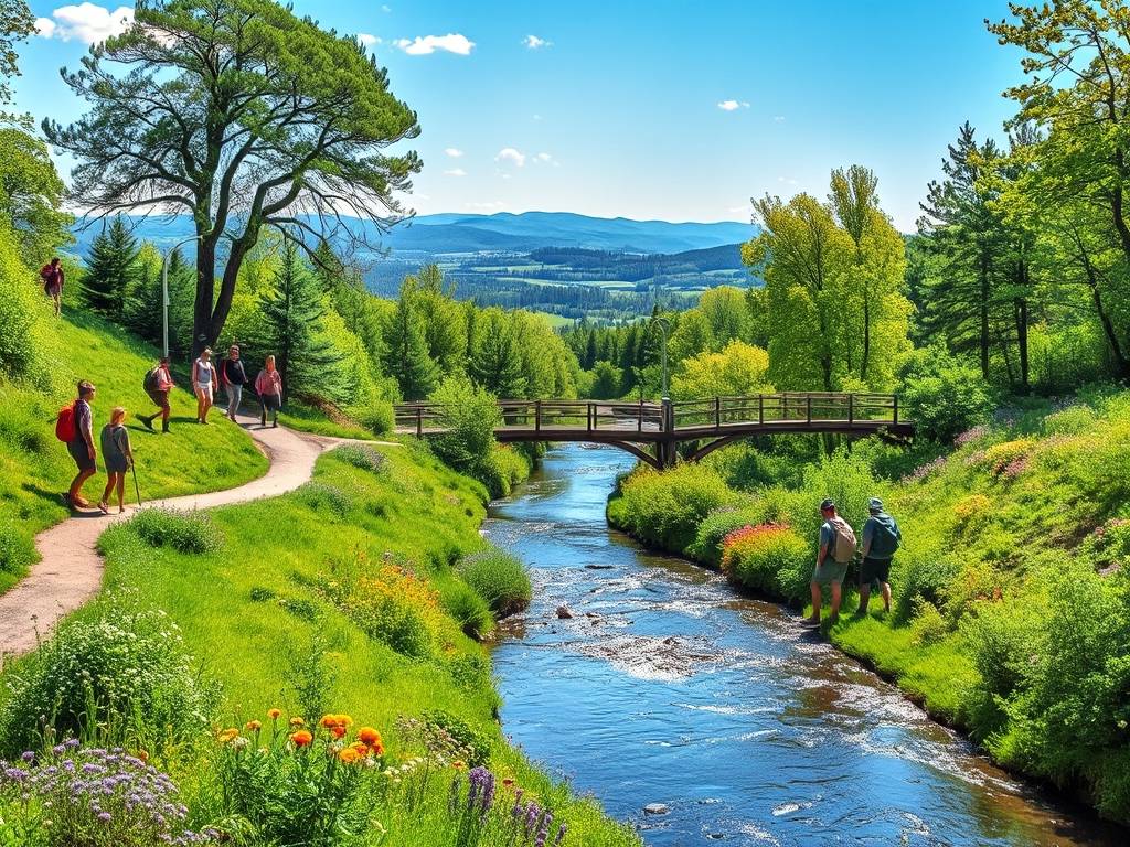
- Elbe River Hiking Trails: Scenic Paths Along the Waterway
- Cities Along Elbe River: Must-See Destinations in Germany
- Elbe River Historical Significance: Key Events Through Time
- Elbe River Water Level Today: Real-Time Updates for Boaters
- Elbe River Cycling Routes: Explore by Bike This Year
- Elbe River Wildlife Watching: Where to Spot Birds & Animals
- Elbe River Local Festivals: 2025 Events Not to Miss
- Elbe River Accommodation: Best Hotels Near the Water
- Elbe River Fishing Spots: Permits & Top Locations
发表评论
评论列表
- 这篇文章还没有收到评论,赶紧来抢沙发吧~